Source: Junos / Getty
*A WINTER STORM WARNING for Frederick County, Maryland, and western Loudoun and northern Fauquier counties in Virginia from 1 a.m. until 10 a.m. Tuesday*
*A WINTER WEATHER ADVISORY for the entire listening area from 1 a.m. until 10 a.m. Tuesday*
Monday’s weather is looking like a “layer-cake wintry mess,” says Storm Team 4 meteorologist Tom Kierein, as a second wave of snow is headed for the area.
The D.C. metro area is largely getting a break from the snow in the early hours, but Kierein says Monday’s storm is tracking farther south than previously expected, with up to 7 inches already on the ground in St. Mary’s and Calvert counties, in Maryland.
Other area snow totals:
- 3.2 inches in Culpeper, Virginia
- 2.5 inches in Prince George’s County, Maryland
- 2.1 inches in Fairfax, Virginia
That snow will head up to the immediate D.C. area, arriving between 10 and 11 a.m., Kierein says; it will continue until 3 to 4 p.m., and we won’t be out of the woods after that.
Kierein says it will total 6 inches in the metro area, more to the south, before it changes over over to sleet and freezing rain, which could put a quarter-inch of ice on top of the snow. “It’s going to be pretty messy here for the afternoon,” he adds.
Late Monday night, it will change over to rain, continuing into Tuesday with highs in the low to mid-50s. And if that’s not enough, we’ll then have to look out for flooding.
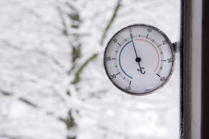
Occasional snow Monday morning into mid-afternoon will total 3 to 5 inches before a changeover to sleet and freezing rain around 4 p.m. Sleet and freezing rain will continue until around 11 p.m. with up to a quarter-inch ice accumulation on top of the snow. By midnight, it will likely change to all rain, which will continue into midday Tuesday. The combination of snow melting and rain may cause some flooding by Tuesday noontime. Temperatures will stay below freezing until about 10 p.m., then climbing into the 40s after midnight into Tuesday morning. By Tuesday afternoon it will be in the low to mid-50s.
MONDAY: Snow likely into mid-afternoon, then sleet/freezing rain.
Highs: Slowly climbing — 20s to low 30s
MONDAY NIGHT: Sleet/freezing rain until 10 p.m., then rain
Temps: 40s by dawn
TUESDAY: Rainy and milder
High 54
WEDNESDAY: Chance of sprinkles or flurries in the morning, partly sunny in the afternoon
High 51
source: WTOP.com